
In the Shadow of the Bitterroots, Part One
Season 40 Episode 4 | 26m 46sVideo has Closed Captions
Ancient Nez Perce trails, border history and mountain science come alive in the Bitterroots.
Idaho's Bitterroot Mountains hold layers of history and science. We walk an 11,000-year-old Nez Perce trail once used to cross into buffalo country, uncover the story behind Idaho's squiggly eastern border, and join geologists and young wilderness rangers who clear trail deep in the Selway-Bitterroot.
Problems playing video? | Closed Captioning Feedback
Problems playing video? | Closed Captioning Feedback
Outdoor Idaho is a local public television program presented by IdahoPTV
Major Funding by the Laura Moore Cunningham Foundation. Additional Funding by the Corporation for Public Broadcasting and the Friends of Idaho Public Television.
In the Shadow of the Bitterroots, Part One
Season 40 Episode 4 | 26m 46sVideo has Closed Captions
Idaho's Bitterroot Mountains hold layers of history and science. We walk an 11,000-year-old Nez Perce trail once used to cross into buffalo country, uncover the story behind Idaho's squiggly eastern border, and join geologists and young wilderness rangers who clear trail deep in the Selway-Bitterroot.
Problems playing video? | Closed Captioning Feedback
Where to Watch Outdoor Idaho
Outdoor Idaho is available to stream on pbs.org and the PBS app.
Outdoor Idaho on YouTube
Can't get enough Outdoor Idaho? Neither can we. Subscribe to the Outdoor Idaho YouTube channel for even more great content. You'll find full episodes, sneak peeks, behind-the-scenes footage, and exclusive content you won't find anywhere else. Subscribe today!Providing Support for PBS.org
Learn Moreabout PBS online sponsorshipMore from This Collection
Central Idaho
In the Shadow of the Bitterroots, Part Two
Video has Closed Captions
Biking, rafting, skiing and climbing: adventure abounds in Idaho's rugged Bitterroots. (26m 46s)
Video has Closed Captions
We explore the largest forested wilderness in the lower 48. (26m 46s)
Video has Closed Captions
Explore the unearthy wonders of Craters of the Moon. (26m 49s)
Video has Closed Captions
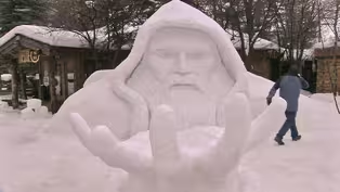
Find out about the fun and offbeat events in and around the McCall Winter Carnival. (26m 47s)
Video has Closed Captions
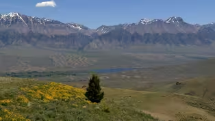
We explore Idaho's highest mountain range and the towns nearby. (26m 47s)
In the Shadow of the Bitterroots Special
Video has Closed Captions
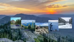
“In the Shadow of the Bitterroots” will tell the stories of the Bitterroot Mountain range. (56m 46s)
Video has Closed Captions
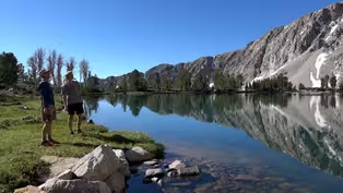
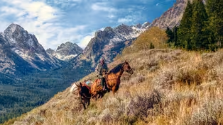
Up above 10,000 feet, the Pioneers remain untouched and intact. (26m 47s)
Video has Closed Captions
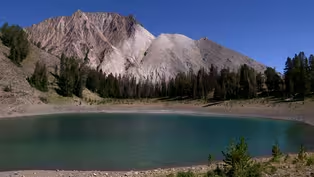
We examine how individuals have been touched by the Sawtooth Mountains. (56m 52s)
Video has Closed Captions
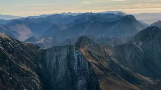
How the threat of an open pit mine led to Wilderness designation. (26m 47s)
Video has Closed Captions
Outdoor Idaho explores “Idaho’s 12ers,” with the climbers who cherish them. (26m 46s)
Video has Closed Captions
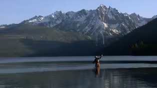
We celebrate the Sawtooth Mountains in central Idaho. (26m 53s)
Salmon River Lodges & Legacies
Video has Closed Captions
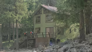
Travel by raft and jet boat down Main Salmon River to rustic lodges and other landmarks. (26m 47s)
Providing Support for PBS.org
Learn Moreabout PBS online sponsorshipLAUREN MELINK, NARRATOR: Granitic and glaciated, the Bitterroot Mountains form the rugged and remote border between Idaho and Montana.
The range and its surroundings include 1.3 million acres of designated wilderness, five national forests, and countless rivers and streams.
CLINT KINGERY, LEAD WILDERNESS STEWARD: It doesn't feel like it's a landscape that's made for us.
It feels like it's a landscape that nature created.
Being out here, you feel like you're exploring true wilderness.
And I can't say that anywhere else I've been has really felt quite as wild as here.
In the shadow of the Bitterroots, there's a reverence for the unpolished and inhospitable terrain, a respect for the challenge the mountains offer up to anyone who dares enter their kingdom.
And there's a tenderness, for misty mornings and for sunsets, for bushwhacking and for burnt trees, for a sense of quiet and of history and of knowing that this, all of this matters more than we can ever know.
Funding for Outdoor Idaho is made possible by the Laura Moore Cunningham Foundation committed to fulfilling the Moore and Bettis family legacy of building the great state of Idaho, by the Friends of Idaho Public Television, by the Corporation for Public for Broadcasting.
TÍSQE ÍLP'ILP, NEZ PERCE LANGUAGE TEACHER, NORTHWEST INDIAN COLLEGE: The Nez Perce people called the Bitterroot Range, the iisl'amíisnima.
iisl'amíisnima in the Nez Perce Language translates to: "The Place with Brook Trout."
So all along the Bitterroot Valley, the Bitterroot Mountains and even into Missoula it was called iisl'amíisnima, the Bitterroots.
MELINK: 11,000 years ago, before fur trappers and Lewis and Clark, before the gold rush, before ski resorts and bike paths, raft trips and motorcycles, the Nez Perce or Nimiipuu lived off the land upon and around the Bitterroot Mountains.
TÍSQE ÍLP'ILP: There's still very sacred places out here, whether it's the Smoking Place or Indian Post Office or down here in the South Fork we have Pilot Knob, in my language is taml'ooyíicmaxs.
Those holy mountains and those sacred places are very important to our people today for a number of reasons, including our resources, our medicines, things that people need every day for our survival.
There's actually place names, in Nez Perce all the way back here into Nez Perce country.
Even in the Bitterroot Mountains, the Trapper Peak, saxsáaxnim iníit, means Ospreys Nest and El Capitan, hinmeetúum iníit, the Thunders Nest.
Even throughout the Selway Crags where the Nez Perce people have these names.
It's not just an empty and void place or like a national forest.
You actually had to get your feet out on the ground to these places and learn about them.
Being so far out in what we call wilderness today, a long time ago, it wasn't wilderness to us, it was just the land.
But being here in holy places or sacred places like this really makes you reach back through thousands of years and know that your ancestors are walking with you.
MELINK: Over time, the Nimiipuu learned to navigate the Bitterroot Mountains with efficiency, taking one or two routes across the range to hunt buffalo.
TÍSQE ÍLP'ILP: The reason why we called this specific trail, wiseískit because one day's travel on foot and you'll come to another good level ground for camping.
So it was called the 'camping trail.'
And it would usually take a few weeks, a week or more, to get over to Montana over the Bitterroots and they'd come out, near today's Darby, Montana.
I would just like to say that these trail systems are very important and our people used them for thousands of years and just to have a respect for the land.
DENNIS BAIRD, SELWAY-BITTERROOT HISTORY PROJECT: It's 10 to 11,000 years old, one of the oldest surviving trails on the planet.
And I think it's probably the oldest surviving trail in North America.
Not nothing comes close to it in terms of age.
And the amazing thing about it being findable is that it's a single route.
it's not multiple routes.
There's not braided trails and whole hillsides full of trails, there's a trail.
They used fire as a management tool.
That's how they kept the trail open.
MELINK: As years passed, the forest did what forest's do best and grew overtop the trail, that is, until retired historian and conservationist Dennis Baird got involved.
BAIRD: We decided to find the trail.
Not roughly where it was, but really where it was because we knew it was very old and the other was to reopen it, not to not to build a new trail, just to reopen the trail on its existing route.
And there had been an effort by the Boy Scouts and others 40 or 50 years ago to sign the trail with little wooden signs.
And they did a very good job.
So they were, their effort was very helpful to us.
MELINK: Clearing trees outside the wilderness boundary means chainsaws are allowed, so in the summer of 2022, Baird along with friend and cohort Ivar Nelson gathered together a group of volunteers who wield chainsaws with absolute finesse.
IVAR NELSON, HISTORIAN: And the great thing about these guys, the, what I want to call the storm troopers, the smokejumpers, is they are heavy equipment people and they just go after those big trees.
You're tripping through forest and it's a, this is an old forest.
So it's not, you know, pristine grass.
And you just walk across that with a few trees.
It's matchsticks everywhere.
And so you're stepping over.
You gotta really watch how you step and it's wet right now, too.
But these guys were great.
So we got a lot done.
MELINK: Over the past ten years, these volunteers have opened 30 to 40 miles of the Southern Nez Perce Trail, an impressive feat, physically and an emotional experience, mentally.
BAIRD: It's the real thing.
It's not roughly where it is.
It's actually where it is and where it always has been for 11,000 years.
It's a powerful experience to simply stop on a quiet day in the woods, standing where, you know people have been standing and walking for 11,000 years and wonder what, what were they doing?
What, where were they going?
What were they thinking when they were, who was it?
Were they here with their family?
It's a wonderful experience to, to stand there and, and think that that's one of the charms of the opened trail.
NELSON: It's an ancient way of people moving around the United States.
There are markers that tell you where the trail was.
The basic one, the very, very basic one is the tread itself.
And it is amazing.
It can be a foot deep, it can be nothing.
BAIRD: People lived along the trail, they hunted along the trail.
There were village sites out here in this country.
And so, I would encourage people to visit the trail.
But just remember whose trail it is.
MELINK: Crossing the Bitterroot Mountain Range in premodern times was no easy task.
Explorers Merriweather Lewis and William Clark learned that the hard way.
KEITH PETERSON, FORMER STATE HISTORIAN: That route was the, by far, the most difficult part of their journey, their route through the Bitterroots.
It was the bane of their existence.
Both going west and east.
That was kind of the thought, probably the most disappointing view in American exploration history was when Merriwether Lewis went to Lemhi Pass that day in 1805 and realized that it's a long ways to the Pacific.
Every story you read about crossing those Bitterroots including the people building the Lewis and Clark Highway, it's all a story of difficult go.
I mean that transportation, that Lewis and Clark highway connecting, you know, basically Missoula with Lewiston didn't happen until the 1960s, MELINK: One has to wonder, if the Bitterroot landscape is so rugged and unforgiving, why was the Idaho Montana border drawn in the way that it was?
Hundreds of miles of squiggly border line over peaks, across ridgelines, and into drainages?
PETERSON: If you look at a map of the west, you look at Wyoming and Colorado and almost, you know, Utah nearly, they're all rectangles and straight lines.
And you look at Idaho and something weird happened here.
The myth of the Bitterroots and how that border came to be.
The most popular is that the surveyors got drunk and lost their way.
And hence we have Lost Trail Pass.
The problem with that story is that Lost Trail Pass was named long before the survey parties even went out.
MELINK: The true story is a lot more complicated than that.
In 1863, Abraham Lincoln signed the act that created the Idaho Territory, a massive piece of land.
PETERSON: It was all of Idaho, all of Montana and virtually all of Wyoming, unmanageable.
The very first thing they did, the very first act of that first territorial legislature was to pass a Memorial to Congress, to shrink the territory.
And they had an idea about how it should be shrunk by this time, people are already calling whatever the new territory is going to be Montana.
So the dividing line between Idaho and Montana should be the continental divide, the Rocky Mountains.
So they sent that into Congress.
MELINK: But then things get a little messy.
Abe Lincoln appoints Sidney Edgerton to be on the Territorial Supreme Court, he makes his way to western Montana and decides the mining boom might hold opportunities for him.
Miners give him 2,500 dollars to lobby for a new border along the Bitterroots, not the divide.
Which would ensure western Montana mining towns stay in Montana.
And by the next year, Montana had withdrawn from the Idaho territory, establishing the Bitterroot Mountains as the state's boundary, all before Idaho could even object.
PETERSON: And it won the day because the Idaho legislature fell asleep at the switch, it's real important to understand that Congress specifically spelled out according to what Sidney Edgerton, asked them to do that the border will run along the crust of the Rocky mountains, northward to its intersection, with the Bitterroot Mountains, to the 39th parallel of longitude, and then basically in a straight line to Canada.
MELINK: And according to Keith Peterson, that decision changed Idaho's trajectory.
PETERSON: What it did was it, it took what had always been an East-West orientation, it created this isolated panhandle and you can't understand Idaho history without understanding you know, now 160 years of trying to connect north and south Idaho, culturally, transportationally, whatever, it's all about, you know, so much of Idaho history at least is about trying to connect north and south because trade don't flow north and south in Idaho.
MELINK: Although lawmakers were able to determine the Bitterroots as the border between Idaho and Montana,for some the actual border of the Bitterroot Mountain Range is still up for debate.
CASSEL: I think of the Bitterroot as the range that runs, from essentially the Lolo Hot Springs area down to the break into the Big Hole Valley.
That would be as a geologist, we would think of that as this, the actual metamorphic core of this complex.
MELINK: But that's not the question geologist Elizabeth Cassel and PhD student Haley Thoresen are here to answer- at least not today.
HALEY THORESEN, PHD STUDENT, UNIVERSITY OF IDAHO: By looking at these volcanics, we can do a multitude of things.
One of which is to date when those volcanics forms, because knowing when those volcanics formed and when they were deposited tells a story of not only how they got there, but knowing kind of how they got there can let us know about the topography of the surrounding region.
CASSEL: We take a bunch of different kinds of samples because we're trying to understand this entire earth process.
What is special about the Bitterroots is they are the result of stretching or extending of the crust on one major fault.
And that fault goes all the way into the middle or lower crust.
And so you're bringing rocks up from very deep, 20, 30 kilometers depth up to the surface, basically in this sort of motion.
And so this is the Bitterroots here that we see today They're not very old; that would've occurred 50 to 40 million years ago.
So not very old on geologic time.
We end up looking for locations in which we would find certain types of volcanic rocks.
We want them to be the right age range that they're gonna actually tell us something about, say the topography at some time in the past.
We went to the road cut first, because someone went in there in the past hundred years and cut that.
So it's gotten into a surface that hasn't been exposed to water and air for a long time, because water and air are going to start to alter the minerals in the rock.
THORESEN: So we usually take like a gallon size sample of rock, and then that's the sample that we will then ultimately take back into the lab and we'll crush it and we will get whatever mineral we want out of it by doing a series of complicated steps.
Essentially from a rock that I've crushed down to a small size faction, I put all of that sand essentially into a liquid that's at a certain density.
And so the important minerals that are denser will fall to the bottom of my sep funnel and all of the other non important minerals or things I don't want will float to the top and so it's a way for me to get a very particular mineral I'm using in my work.
Then I can start to calculate how fast this mountain was growing, how fast it took from the time that that mineral formed to when it cooled past a certain temperature gradient to when it was at the Earth's surface.
CASSEL: To me, I think the fundamental question of understanding the places that we love and that we wanna spend our time and having sort of a greater appreciation for the planet and all of these amazing processes that have taken millions and millions of years and to form these amazing landscapes that we get to spend our time in.
MELINK: There are many ways to enjoy the BItterroot Mountains, and for those who live and work in their shadows, simply looking at the range can be more than enough.
CAROL STOKER, MOUNTAIN VALLEY FARMSTEAD: We love the sheep and we love what we do, we enjoy it, but there's some very challenging times.
But the best remedy for that is just to walk out here and see those beautiful majestic mountains.
And it just does something, it feeds your soul.
MELINK: Carol and Randal Stoker are the owners of Mountain Valley Farmstead in Carmen, Idaho.
RANDAL STOKER, MOUNTAIN VALLEY FARMSTEAD: We make artisan sheep cheese.
We milk the sheep, we make the cheese and package the wedges and sell the cheese.
It's a beautiful location in the Salmon River Valley.
We're in the valley right between the Salmon River Mountains and the Bitterroot range.
We have a beautiful view of the mountains and the pastures that we live on and the sun rises and sun sets almost every day, we say, come and look at this, come and look at this.
You, you can't miss this one.
Everyone's different and everyone's special.
And the same thing with the green valley, the Salmon River Valley is a beautiful place to live.
Just rewarded with beauty every day.
We think the sheep like it here as well as we do.
CAROL STOKER: With sheep, I love their personalities.
They just make us laugh.
They'll just do silly things.
RANDAL STOKER: The sheep become almost extended family.
They become very special to you.
You get to know them very well.
It's great working with animals.
And then we love being able to have a product that people enjoy.
CAROL STOKER: What do I like about sheep cheese?
Everything.
It just has so much more flavor to it and the nutrition, it has probably double the protein, sometimes three times the protein in it.
MELINK: Carol and Randal both have backgrounds in cow dairy, but this was their first foray into sheep's milk, and it took plenty of trial and error to get it right.
RANDAL STOKER: There was some times when our faith was tried, believe me when we were first starting up and stuff, especially.
We've always loved what we do, but now we've, we've been in it long enough that we think we got all the bugs worked out.
We know how to do it well.
CAROL STOKER: I love it all, I do.
It's kind of fun.
It's a lot of different jobs.
I do love milking the sheep.
And I love making cheese.
I think that's probably one of the hardest, just because it is kind of challenging and got a lot of responsibility on you trying to make the best batch of cheese you can.
We just are so blessed.
We feel like we were just kind of led here and I just, I even told him, I can't even imagine us doing this any other place.
We looked at other places, but nothing came through, but this one did and we just absolutely love where we're at.
MELINK: To love where you are means to be fully present, to be absorbed in work that provides fulfillment, emotionally and physically and for some, spiritually.
And sweating it out in nature, can do that.
Just ask the young people who spend their summer clearing trail in the Selway Bitterroot Wilderness.
MACK SCANLIN, WILDERNESS RANGER FELLOW: I was a little nervous, like coming into this just because you know, it's nine days out here with these people and that's it, you know, and the food you brought and that's what you have.
But honestly, it's been great.
Just like completely immersing yourself.
Just being out here makes you really appreciate a lot more and realize how privileged we are just to work out here.
MELINK: The Selway-Bitterroot Frank Church Foundation is an organization with a mission to preserve the natural, pristine character of wilderness.
CAITLIN STRAUBINGER, COMMUNITY ENGAGEMENT DIRECTOR, SBFC: Congress passed the Wilderness Act in 1964 and the Selway Bitterroot was among the first wilderness areas officially designated in the United States.
And so, you know, folks have known that this is a special and important area and it received that, exceptional protection in the sixties.
MELINK: Each summer they hire about a dozen college students from across the country to live and work in the wilderness.
STRAUBINGER: The purpose is to support forest service capacity in the wilderness.
Folks getting out on trails, clearing trails, opening trails, monitoring for wilderness characteristics, and our program helps teach young people this way of life and see if it's something they're interested in doing.
FELLOW: Yes, Alright!
MELINK: Being the third largest designated wilderness in the lower 48, it takes a tremendous effort to maintain trail systems here.
Especially because chainsaw's aren't allowed.
SCANLIN: To learn how to use a tool that people a hundred years ago used and use it for the same things.
It's just really rewarding, I think.
And it's a really cool tool.
Cause' it requires being in sync with your partner and also having upper body strength, which I came into this with none and now like, pretty strong.
MELINK: The wilderness ranger fellows spend a few weeks training before separating into groups of three fellows and one leader, then they'll spend around 8 days working in the wilderness with four to six days off.
KINERGY: I do like to teach, let them kind of fumble around on their own for a bit, go back, teach again, let them fumble around with each other for a bit.
And in, in my experience, this just seems like a really quick way to get them invested and passionate about the work and also learning the skills to the best of their ability.
MELINK: For this group, every day of work starts off the same, with a little breakfast and a little warming up.
CHARLIE WARREN, WILDERNESS RANGER FELLOW: I definitely do feel kind of a deeper connection to nature and capital "W" Wilderness, like untouched area that have very minimal human impact.
It really is something kind of special to me that I think we don't have really enough of either in America or just kind of the rest of the world, of truly kind of primal areas that don't really have any human influence or anything like that.
I really, really value that about this area.
EMANN: It's a good, positive pressure to be able to have that self willpower to be like, okay, I don't wanna wake up, but I'm going to, because this is going to be a good day and I'm going to make it a good day.
And once I get back out there into the woods and I'm looking over the mountain ranges and cutting trees and seeing wildlife and picking mushrooms, it's gonna be fun once I get back into it.
SCANLIN: It's so worth it.
Do this.
If you can do this, do it.
It's life changing.
I've made like the best friends I possibly could and learned so many cool things.
And this organization has just brought a lot to my life that I didn't really know I needed.
And now that I'm like, I don't know what I'm gonna do, like once it's over.
Funding for Outdoor Idaho is made possible by the Laura Moore Cunningham Foundation committed to fulfilling the Moore and Bettis family legacy of building the great state of Idaho, by the Friends of Idaho Public Television, by the Corporation for Public for Broadcasting.
To find more information about these shows visit us at:
 New Episode
- Science and Nature

Explore scientific discoveries on television's most acclaimed science documentary series.
 From My Station

 New Season
 New Season



Support for PBS provided by:
Outdoor Idaho is a local public television program presented by IdahoPTV
Major Funding by the Laura Moore Cunningham Foundation. Additional Funding by the Corporation for Public Broadcasting and the Friends of Idaho Public Television.